Project overview
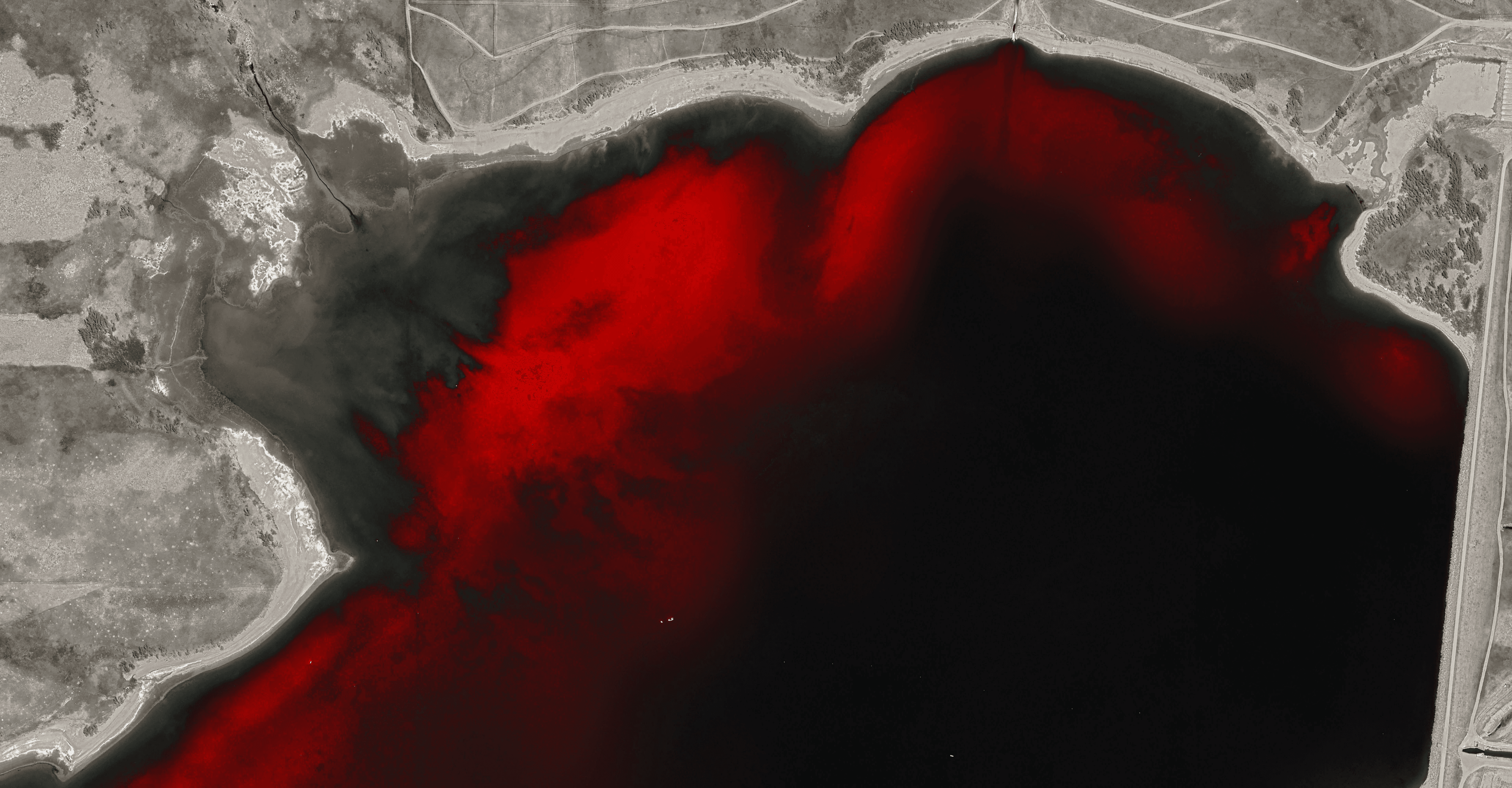
Achieved an overall accuracy of 94% using the Random Forest supervised machine learning model to identify and classify areas with the invasive aquatic plant Eurasian Watermilfoil in the Boulder Reservoir (personal project) using Sentinel 2 satellite imagery on Google Earth Engine.
Project type
AI Computer Vision
Year
2025
My role
Personal project
Client
N/A
Tools used
Google Earth Engine & QGIS

Above shows the areas the model classified as aquatic vegetation in red pixels. Below are two validation visualizations. The first shows the true color imagery from the Sentinel satellite, with the milfoil clearly visible. The second, with dots, shows an overlay of points classified as vegetation by a sonar device used for mapping the milfoil.


The way computers are able to recognize these areas is because of the reflectance of light put out by the plant. Chlorophyll, associated with being more prominent in healthy vegetation, reflects more light in the red edge and near infrared spectrum. I found that the Normalized Difference Chlorophyll Index (NDCI) is most effective at identifying the emergent and especially submerged vegetation, compared to more established alternatives.
The Floating Algea Index (FAI), however, is typically sensitive to emergent vegetation over submerged. We can plot the standard deviation between the NDCI and the FAI to be able to plot new growth, shown on the left. This information is potentially valuable for forecasting growth and evaluating effectiveness of mitigation techniques.